Big Data Analytics with Google Colab and Apache Spark Training Course
Big Data Analytics with Google Colab and Apache Spark is a powerful approach to processing and analyzing massive datasets efficiently.
This instructor-led, live training (online or onsite) is aimed at intermediate-level data scientists and engineers who wish to use Google Colab and Apache Spark for big data processing and analytics.
By the end of this training, participants will be able to:
- Set up a big data environment using Google Colab and Spark.
- Process and analyze large datasets efficiently with Apache Spark.
- Visualize big data in a collaborative environment.
- Integrate Apache Spark with cloud-based tools.
Format of the Course
- Interactive lecture and discussion.
- Lots of exercises and practice.
- Hands-on implementation in a live-lab environment.
Course Customization Options
- To request a customized training for this course, please contact us to arrange.
Thank you for sending your enquiry! One of our team members will contact you shortly.
Thank you for sending your booking! One of our team members will contact you shortly.
Course Outline
Introduction to Google Colab and Apache Spark
- Overview of Google Colab
- Introduction to Apache Spark
- Setting up Spark in Google Colab
Data Processing with Apache Spark
- Working with RDDs and DataFrames
- Loading and processing large datasets
- Using Spark SQL for querying structured data
Advanced Analytics with Spark
- Machine learning with Spark MLlib
- Performing real-time data analysis
- Distributed computing with Spark
Visualization and Collaboration in Google Colab
- Integrating Colab with popular visualization libraries
- Collaborative workflows with Colab notebooks
- Sharing and exporting results
Optimizing Big Data Workflows
- Tuning Spark for performance
- Optimizing memory and storage usage
- Scaling workflows for large datasets
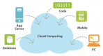
Big Data in the Cloud
- Integrating Google Colab with cloud-based tools
- Using cloud storage for big data
- Working with Spark in distributed cloud environments
Case Studies and Best Practices
- Review of real-world big data applications
- Case studies using Apache Spark and Colab
- Best practices for big data analytics
Summary and Next Steps
Requirements
- Basic knowledge of data science concepts
- Familiarity with Apache Spark
- Python programming skills
Audience
- Data scientists
- Data engineers
- Researchers working with big data
14 Hours
Open Training Courses require 5+ participants.
Big Data Analytics with Google Colab and Apache Spark Training Course - Booking
Big Data Analytics with Google Colab and Apache Spark Training Course - Enquiry
Big Data Analytics with Google Colab and Apache Spark - Consultancy Enquiry
Consultancy Enquiry
Testimonials (5)
Hands-on examples allowed us to get an actual feel for how the program works. Good explanations and integration of theoretical concepts and how they relate to practical applications.
Ian - Archeoworks Inc.
Course - ArcGIS Fundamentals
Lab exercise
Tse Kiat - ST Engineering Training & Simulation Systems Pte. Ltd.
Course - Automated Monitoring with Zabbix
All the topics which he covered including examples. And also explained how they are helpful in our daily job.
madduri madduri - Boskalis Singapore Pte Ltd
Course - QGIS for Geographic Information System
I liked Pablo's style, the fact that he covered a lot of subjects from report design , customization with html to implementing simple ML algortithms. Good balance theoretical information / exercices. Pablo really covered all topics i was interested in and gave comprehensive answers to my questions.
Cristian Tudose - SC Automobile Dacia SA
Course - Advanced Data Analysis with TIBCO Spotfire
Good hands on experience with the tool and excellent documentation provided
Ryan McNamara - Penten
Course - Nagios XI Administration
Provisional Courses
Related Courses
Advanced Data Analysis with TIBCO Spotfire
14 HoursThis instructor-led, live training in Poland (online or onsite) is aimed at business analysts who wish to learn advanced Spotfire Analyst techniques for analyzing data.
By the end of this training, participants will be able to:
- Share visualizations among different team members.
- Secure access to software based on roles and access controls.
- Create visualizations such as map charts.
- Integrate statistical computing languages such as R with Spotfire.
Read more...
ArcGIS from Basic to Advanced
35 HoursThis instructor-led, live training in Poland (online or onsite) is aimed at beginner-level to advanced-level GIS professionals and analysts who wish to learn how to effectively use ArcGIS for data visualization, spatial analysis, and geospatial project management.
By the end of this training, participants will be able to:
- Navigate and utilize ArcGIS tools for geospatial data management.
- Create and customize maps with layers and attributes.
- Perform advanced spatial analysis and geoprocessing tasks.
- Automate workflows using ModelBuilder and Python.
Read more...
ArcGIS Enterprise for Technical Support
14 HoursThis instructor-led, live training in Poland (online or onsite) is aimed at beginner-level IT support personnel who wish to provide robust support for ArcGIS Enterprise, addressing any anomalies or failures effectively.
By the end of this training, participants will be able to:
- Understand the architecture and components of ArcGIS Enterprise.
- Learn to install, configure, and manage ArcGIS Enterprise.
- Gain skills in troubleshooting and resolving common issues.
- Develop proficiency in monitoring and maintaining ArcGIS Enterprise environments.
- Master the techniques for backup, recovery, and performance optimization.
Read more...
ArcGIS Fundamentals
14 HoursThis instructor-led, live training in Poland (online or onsite) is aimed at beginner-level professionals who wish to learn the fundamental concepts and tools of ArcGIS.
By the end of this training, participants will be able to:
- Understand the basic concepts of GIS and spatial data.
- Navigate the ArcGIS interface.
- Create and manage spatial data.
- Perform basic spatial analysis.
- Create maps and visualizations.
Read more...
Advanced ArcGIS Pro for Spatial Analysis
35 HoursThis instructor-led, live training in Poland (online or onsite) is aimed at advanced-level GIS professionals who wish to use ArcGIS Pro to enhance their spatial analysis capabilities, conduct comprehensive geostatistical analysis, and apply advanced 3D modeling techniques for more effective decision-making and problem-solving in real-world scenarios.
By the end of this training, participants will be able to:
- Develop advanced skills in spatial analysis techniques using ArcGIS Pro.
- Utilize Python scripting for automation and complex data processing.
- Apply spatial modeling for problem-solving in real-world scenarios.
- Conduct geostatistical analysis for advanced data interpretation.
- Integrate external data sources and leverage 3D spatial data analysis.
Read more...
Automated Monitoring with Zabbix
14 HoursThis instructor-led, live training in Poland (online or onsite) covers the installation, planning and configuration of Zabbix, and focuses on practical implementation and tooling.
By the end of this training, participants will be able to:
- Install and configure Zabbix for monitoring IT infrastructure.
- Set up and manage hosts, items, triggers, and actions within Zabbix.
- Utilize Zabbix's features for data collection, alerting, and reporting.
- Integrate Zabbix with other tools and platforms for enhanced monitoring and automation.
Read more...
Insurtech: A Practical Introduction for Managers
14 HoursInsurtech (a.k.a Digital Insurance) refers to the convergence of insurance + new technologies. In the field of Insurtech "digital insurers" apply technology innovations to their business and operating models in order to reduce costs, improve the customer experience and enhance the agility of their operations.
In this instructor-led training, participants will gain an understanding of the technologies, methods and mindset needed to bring about a digital transformation within their organizations and in the industry at large. The training is aimed at managers who need to gain a big picture understanding, break down the hype and jargon, and take the first steps in establishing an Insurtech strategy.
By the end of this training, participants will be able to:
- Discuss Insurtech and all its component parts intelligently and systematically
- Identify and demystify the role of each key technology within Insurtech.
- Draft a general strategy for implementing Insurtech within their organization
Audience
- Insurers
- Technologists within the insurance industry
- Insurance stakeholders
- Consultants and business analysts
Format of the course
- Part lecture, part discussion, exercises and case study group activities
Read more...
Fluentd for Log Data Unification
14 HoursThis instructor-led, live training (online or onsite) is aimed at engineers who wish to set up an architecture where everything is logged.
By the end of this training, participants will be able to:
- Install and configure Fluentd.
- Collect logs from large numbers of disparate servers.
- Unify the logging layer within an organization.
Format of the Course
- Interactive lecture and discussion.
- Lots of exercises and practice.
- Hands-on implementation in a live-lab environment.
Course Customization Options
- This training covers logging approaches for various types of systems. Please contact us to arrange coverage for specific systems (syslog, Apache, Nginx, IoT, ElasticSearch, MongoDB, Hadoop, etc.).
- To learn more about Fluentd, please visit: https://www.fluentd.org/
Read more...
Nagios
35 HoursThis instructor-led, live training in Poland (online or onsite) is aimed at intermediate-level IT professionals who wish to implement and manage infrastructure monitoring using Nagios.
By the end of this training, participants will be able to:
- Install and configure Nagios Core and relevant plugins.
- Monitor servers, network devices, services, and applications.
- Configure alerts and performance thresholds.
- Integrate Nagios with databases and third-party tools.
- Set up distributed monitoring and high availability environments.
- Visualize monitoring data using tools such as NagVis and BPI.
Read more...
Nagios Core
21 HoursThis instructor-led, live training in Poland (online or onsite) is aimed at intermediate-level IT professionals who wish to implement, configure, and maintain Nagios Core for real-time infrastructure monitoring.
By the end of this training, participants will be able to:
- Install and configure Nagios Core and its components.
- Monitor hosts, services, and network resources.
- Configure secure user access and alerting systems.
- Create custom checks and extend Nagios monitoring capabilities.
- Utilize plugins and graphing tools for reporting and analysis.
Read more...
Nagios XI Administration
21 HoursNagios XI is enterprise server and network monitoring software.
In this instructor-led, live training, participants will learn how to set up and operate Nagios XI as they step through process of managing Linux and Windows servers in a series of hands-on live-lab exercises.
By the end of this training, participants will be able to:
- Install and configure Nagios XI
- Monitor Windows and Linux machines
- Monitor network devices
- Perform administrating tasks, including backing up, restoring, and scheduling downtime of Nagios XI
Audience
- System administrators
Format of the Course
- Part lecture, part discussion, exercises and heavy hands-on practice
Note
- To request a customized training for this course, please contact us to arrange.
Read more...
QGIS for Geographic Information System
21 HoursA geographic information system (GIS) is a system designed to capture, store, manipulate, analyze, manage, and present spatial or geographic data. The acronym GIS is sometimes used for geographic information science (GIScience) to refer to the academic discipline that studies geographic information systems and is a large domain within the broader academic discipline of geoinformatics.
QGIS functions as geographic information system (GIS) software, allowing users to analyze and edit spatial information, in addition to composing and exporting graphical maps. QGIS supports both raster and vector layers; vector data is stored as either point, line, or polygon features. Multiple formats of raster images are supported, and the software can georeference images. To summarize it allows the users to Create, edit, visualise, analyse and publish geospatial information on Windows, Mac, Linux, BSD.
This program, in its first phase, introduces the QGIS interface for general usage. In the second phase, we introduce PyQGIS - the python libraries of QGIS that allows the integration of GIS functionalities in your python code or your python application, so that you may even create your own Python Plugin around a particular GIS functionality.
Read more...
Introduction to Spotfire
14 HoursThis instructor-led, live training in Poland (online or onsite) is aimed at business analysts and data analysts who wish to learn basic Spotfire Analyst techniques for analyzing data.
By the end of this training, participants will be able to:
- Install and configure TIBCO Spotfire.
- Combine data from different databases.
- Visualize large datasets.
- Create and share complex dashboards.
Read more...
AI-Driven Data Analysis with TIBCO Spotfire X
14 HoursThis instructor-led, live training in Poland (online or onsite) is aimed at business analysts and data analysts who wish to use TIBCO Spotfire X with its artificial intelligence capabilities to visualize, transform, and analyze data.
By the end of this training, participants will be able to:
- Install and configure TIBCO Spotfire X.
- Understand the features and architecture of TIBCO Spotfire X.
- Understand the concepts behind augmented and predictive analytics.
- Learn how to load, process, and visualize data using Spotfire X.
- Create interactive and enhanced data visualizations.
Read more...
Data Analysis with SQL, Python and Spotfire
14 HoursIn this instructor-led, live training in Poland, participants will learn three different approaches for accessing, analyzing and visualizing data. We start with an introduction to RDMS databases; the focus will be on accessing and querying an Oracle database using the SQL language. Then we look at strategies for accessing an RDMS database programmatically using the Python language. Finally, we look at how to visualize and present data graphically using TIBCO Spotfire.
Format of the Course
Interactive lecture and discussion.
Lots of exercises and practice.
Hands-on implementation in a live-lab environment.
Read more...