Online or onsite, instructor-led live Spatial Analysis (also known as Spatial Statistics, Spatial Analytics, Geospatial Analysis, Geospatial Analytics, Geo-Spatial Analysis, and Geo-Spatial Analytics) training courses demonstrate through interactive discussion and hands-on practice how such analysis employs software capable of rendering maps, processing spatial data, and applying analytical methods to terrestrial or geographic datasets, including the use of geographic information systems and geomatics.
Spatial Analysis training is available as "online live training" or "onsite live training". Online live training (aka "remote live training") is carried out by way of an interactive, remote desktop. Onsite live Spatial Analysis trainings in lubelskie can be carried out locally on customer premises or in NobleProg corporate training centers.
NobleProg -- Your Local Training Provider
Zamość
Ośrodek Sportu i Rekreacji , Królowej Jadwigi 8 , Zamość, Poland, 22-400
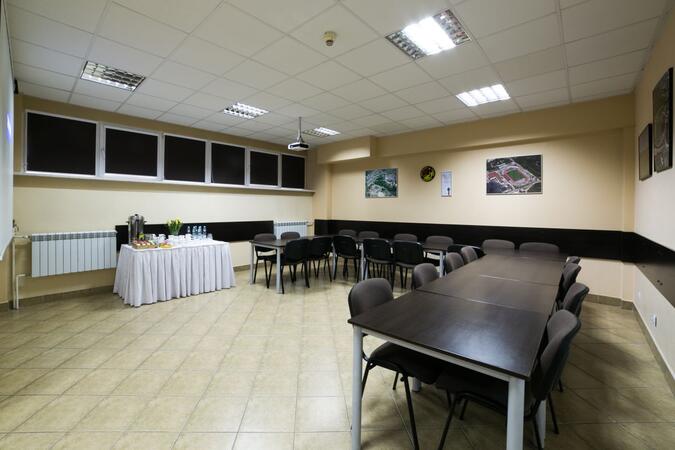
The training room, located in the central part of Zamość, serves as an ideal venue for workshops. Its strategic location makes it easily accessible to participants from various parts of the city and neighboring towns. Additionally, this room stands out with its rich equipment, enabling the conduct of courses in an efficient and professional manner.
Lublin
Hotel Trzy Róże, Zemborzyce Dolne 96a, Lublin, Poland, 20-515
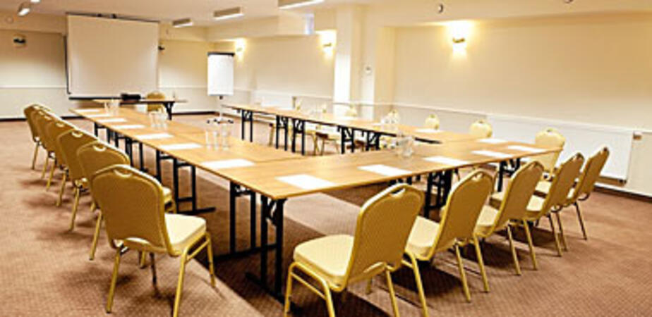
The training rooms are equipped with modern audiovisual equipment, enabling effective presentations and interactive training sessions. Additionally, there is fast and reliable internet available, facilitating easy access to online materials and communication with the training team. The facility is located just 9 kilometers from the center of Lublin. Situated on the main S19 route towards Kraśnik, it provides convenient access from Rzeszów, Warsaw, Łódź, and Białystok. Thanks to this central location, participants can quickly and comfortably reach the training venue, further easing event organization and ensuring participant comfort.
This instructor-led, live training in lubelskie (online or onsite) is aimed at beginner-level to advanced-level GIS professionals and analysts who wish to learn how to effectively use ArcGIS for data visualization, spatial analysis, and geospatial project management.
By the end of this training, participants will be able to:
Navigate and utilize ArcGIS tools for geospatial data management.
Create and customize maps with layers and attributes.
Perform advanced spatial analysis and geoprocessing tasks.
This instructor-led, live training in lubelskie (online or onsite) is aimed at advanced-level GIS professionals who wish to use ArcGIS Pro to enhance their spatial analysis capabilities, conduct comprehensive geostatistical analysis, and apply advanced 3D modeling techniques for more effective decision-making and problem-solving in real-world scenarios.
By the end of this training, participants will be able to:
Develop advanced skills in spatial analysis techniques using ArcGIS Pro.
Utilize Python scripting for automation and complex data processing.
Apply spatial modeling for problem-solving in real-world scenarios.
Conduct geostatistical analysis for advanced data interpretation.
Integrate external data sources and leverage 3D spatial data analysis.
This instructor-led, live training in lubelskie (online or onsite) is aimed at beginner-level IT support personnel who wish to provide robust support for ArcGIS Enterprise, addressing any anomalies or failures effectively.
By the end of this training, participants will be able to:
Understand the architecture and components of ArcGIS Enterprise.
Learn to install, configure, and manage ArcGIS Enterprise.
Gain skills in troubleshooting and resolving common issues.
Develop proficiency in monitoring and maintaining ArcGIS Enterprise environments.
Master the techniques for backup, recovery, and performance optimization.
This instructor-led, live training in lubelskie (online or onsite) is aimed at beginner-level professionals who wish to learn the fundamental concepts and tools of ArcGIS.
By the end of this training, participants will be able to:
Understand the basic concepts of GIS and spatial data.
This instructor-led, live training in lubelskie (online or onsite) is aimed at beginner-level earth sciences and engineering professionals who wish to use Python for geospatial analysis in both ArcGIS and QGIS environments.
By the end of this training, participants will be able to:
Learn Python syntax and control structures for executing geospatial tasks efficiently.
Use Pandas, Numpy, and Matplotlib for data analysis and visualization in GIS.
Manipulate and analyze vector data with Geopandas, Arcpy, and PyQGIS libraries.
Automate geospatial processes and workflows using Python scripting in ArcGIS and QGIS.
Develop custom Python-based geoprocessing tools for ArcGIS and QGIS to streamline tasks.
This instructor-led, live training in lubelskie (online or onsite) is aimed at intermediate-level geographers who wish to deepen their expertise in spatial analysis, data management, and GIS applications.
By the end of this training, participants will be able to:
Apply advanced spatial analysis techniques to solve complex geographical problems.
Manage large spatial databases and perform data quality control.
Create dynamic and interactive maps and visualizations for various applications.
Utilize programming and automation to streamline GIS workflows.
A geographic information system (GIS) is a system designed to capture, store, manipulate, analyze, manage, and present spatial or geographic data. The acronym GIS is sometimes used for geographic information science (GIScience) to refer to the academic discipline that studies geographic information systems and is a large domain within the broader academic discipline of geoinformatics.
The use of Python with GIS has substantially increased over the last two decades, particularly with the introduction of Python 2.0 series in 2000, which included many new programming features that made the language much easier to deploy. Since that time, Python has not only been utilized within commercial GIS such as products by Esri but also open source platforms, including as part of QGIS and GRASS. In fact, Python today is by far the most widely used language by GIS users and programmers.
This program covers the usage of Python and its advance libraries like geopandas, pysal, bokeh and osmnx to implement your own GIS features. The program also covers introductory modules around ArcGIS API, and QGIS toolboox.
This instructor-led, live training in lubelskie (online or onsite) is aimed at developers who wish to enhance their website or web application by adding geo-location functionality through Google Maps.
By the end of this training, participants will be able to:
Embed a map into a new or existing website or web application.
Display live data that synchs with current location.
This instructor-led, live training in lubelskie (online or onsite) is aimed at field ecologists and conservation managers who wish to post-process Pix4D drone data.
By the end of this training, participants will be able to:
Implement Google Earth to enhance UAV mapping .
Use outputs of images to generate reports.
Post-process with GIS and CAD software for advanced drone data modeling.
This instructor-led, live training in lubelskie (online or onsite) is aimed at field ecologists and conservation managers who wish to land survey and drone map with Pix4D.
By the end of this training, participants will be able to:
Use end to end drone mapping processes and techniques.
Achieve high surveying accuracy.
Understand the fundamentals of global coordinate systems and GPS.
Generate and analyze survey output with Pix4D's image processing software.
A geographic information system (GIS) is a system designed to capture, store, manipulate, analyze, manage, and present spatial or geographic data. The acronym GIS is sometimes used for geographic information science (GIScience) to refer to the academic discipline that studies geographic information systems and is a large domain within the broader academic discipline of geoinformatics.
QGIS functions as geographic information system (GIS) software, allowing users to analyze and edit spatial information, in addition to composing and exporting graphical maps. QGIS supports both raster and vector layers; vector data is stored as either point, line, or polygon features. Multiple formats of raster images are supported, and the software can georeference images. To summarize it allows the users to Create, edit, visualise, analyse and publish geospatial information on Windows, Mac, Linux, BSD.
This program, in its first phase, introduces the QGIS interface for general usage. In the second phase, we introduce PyQGIS - the python libraries of QGIS that allows the integration of GIS functionalities in your python code or your python application, so that you may even create your own Python Plugin around a particular GIS functionality.
Read more...
Last Updated:
Testimonials (3)
Hands-on examples allowed us to get an actual feel for how the program works. Good explanations and integration of theoretical concepts and how they relate to practical applications.
Ian - Archeoworks Inc.
Course - ArcGIS Fundamentals
All the topics which he covered including examples. And also explained how they are helpful in our daily job.
madduri madduri - Boskalis Singapore Pte Ltd
Course - QGIS for Geographic Information System
I really enjoyed the training. I found all modules to be applicable to problems that I am trying to solve at work. The integration of the training with jupyter notebooks was really impressive.
Mark Firmin - Environment and Climate Change Canada
Course - Python for Geographic Information System (GIS)
Online Geospatial Analysis training in lubelskie, Geospatial Analytics training courses in lubelskie, Weekend Spatial Analysis courses in lubelskie, Evening Geo-Spatial Analytics training in lubelskie, Spatial Statistics instructor-led in lubelskie, Geospatial Analytics instructor-led in lubelskie, Geospatial Analysis classes in lubelskie, Spatial Statistics one on one training in lubelskie, Evening Spatial Statistics courses in lubelskie, Online Spatial Statistics training in lubelskie, Geospatial Analytics instructor in lubelskie, Spatial Analysis boot camp in lubelskie, Geo-Spatial Analysis private courses in lubelskie, Geo-Spatial Analysis coaching in lubelskie, Weekend Geo-Spatial Analytics training in lubelskie, Spatial Analytics on-site in lubelskie, Spatial Analytics trainer in lubelskie