Online or onsite, instructor-led live Pix4D training courses demonstrate through interactive hands-on practice how to analyze image data and create 3D models with Pix4D.
Pix4D training is available as "online live training" or "onsite live training". Online live training (aka "remote live training") is carried out by way of an interactive, remote desktop. Trojmiasto onsite live Pix4D trainings can be carried out locally on customer premises or in NobleProg corporate training centers.
NobleProg -- Your Local Training Provider
Gdynia
Hotel Nadmorski, Ejsmonda 2, Gdynia, Poland, 81-409
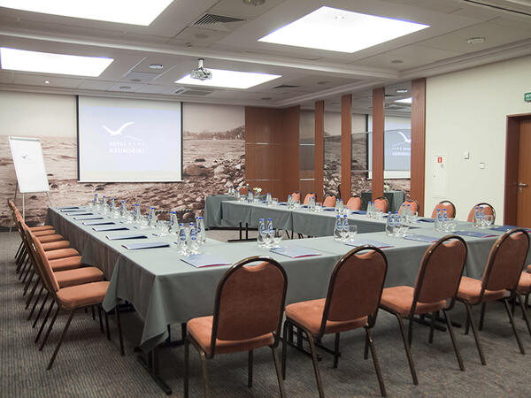
The training room is located just 3 kilometers from the PKP/PKS Station in Gdynia, making it easily accessible for participants traveling by train or bus. Additionally, it is only 400 meters away from the bus stop, facilitating access even for those using public transportation. It is equipped with necessary training tools such as a projector, screen, and flipchart, providing comfortable conditions for both participants and the trainer.
Gdańsk
Hotel Fahrenheit, Grodzka 19, Gdańsk, Poland, 80-841
The training room is located in the very heart of the picturesque Gdansk Old Town, making the surroundings not only inspiring but also exceptionally attractive for participants. Within close proximity, you can find the railway and bus stations, facilitating arrival for those traveling by both train and bus. Additionally, the airport and port are also within reach, making this location convenient for individuals coming from distant places, both domestically and internationally.
This instructor-led, live training in Trojmiasto (online or onsite) is aimed at field ecologists and conservation managers who wish to post-process Pix4D drone data.
By the end of this training, participants will be able to:
Implement Google Earth to enhance UAV mapping .
Use outputs of images to generate reports.
Post-process with GIS and CAD software for advanced drone data modeling.
This instructor-led, live training in Trojmiasto (online or onsite) is aimed at field ecologists and conservation managers who wish to land survey and drone map with Pix4D.
By the end of this training, participants will be able to:
Use end to end drone mapping processes and techniques.
Achieve high surveying accuracy.
Understand the fundamentals of global coordinate systems and GPS.
Generate and analyze survey output with Pix4D's image processing software.
Online Pix4D training in Trojmiasto, Pix4D training courses in Trojmiasto, Weekend Pix4D courses in Trojmiasto, Evening Pix4D training in Trojmiasto, Pix4D instructor-led in Trojmiasto, Pix4D boot camp in Trojmiasto, Pix4D trainer in Trojmiasto, Weekend Pix4D training in Trojmiasto, Pix4D one on one training in Trojmiasto, Pix4D private courses in Trojmiasto, Pix4D instructor in Trojmiasto, Pix4D classes in Trojmiasto, Online Pix4D training in Trojmiasto, Evening Pix4D courses in Trojmiasto, Pix4D coaching in Trojmiasto, Pix4D instructor-led in Trojmiasto, Pix4D on-site in Trojmiasto